Jennifer Lauren Smith in conversation with Amanda Sauer
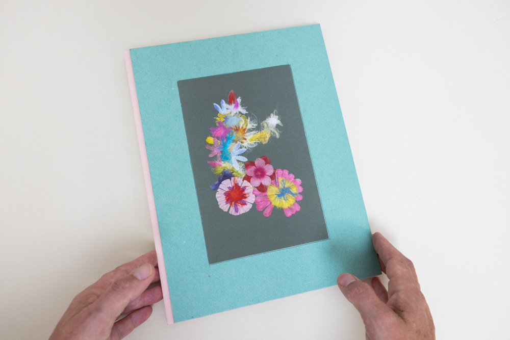
© Jennifer Lauren Smith, Weeping European Beech Baby Tonic
Jennifer Lauren Smith is an artist with a background in sculpture and the humanities, working primarily in analog photography, video, and performance. Her practice is informed by her experience as a deaf person — existing in a soundscape of fragments, residual hearing, guesswork, and hypervigilance. She utilizes this fractured, embodied process to create experimental visual narratives exploring manifestations of sound, silence, and body memory.
Her process begins with fieldwork. She works outdoors, researching historical locations and collecting material in situ, then brings it back to the studio to process. As an observer and archivist, she writes, scans, uses clay, and choreographs performers to manifest embellished memories, developing a narrative think-feel experience.
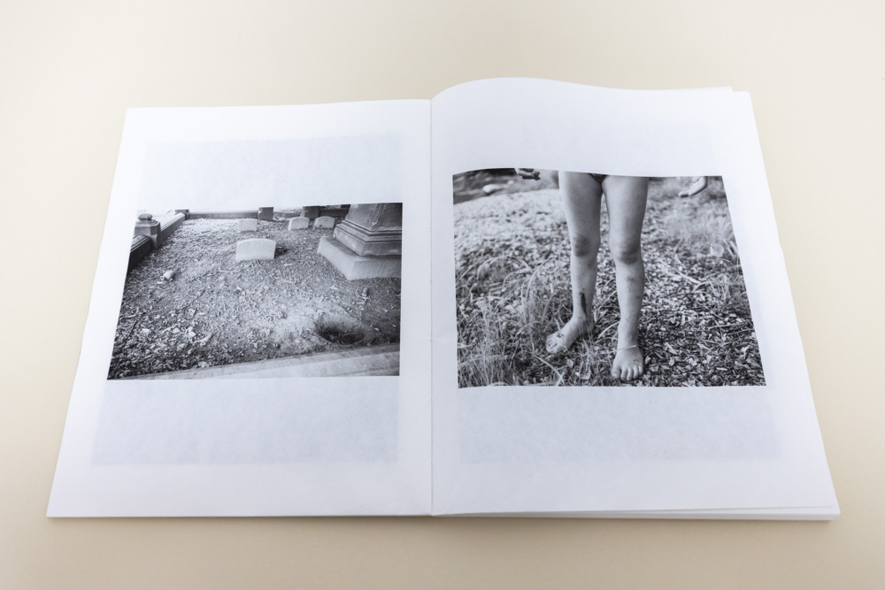
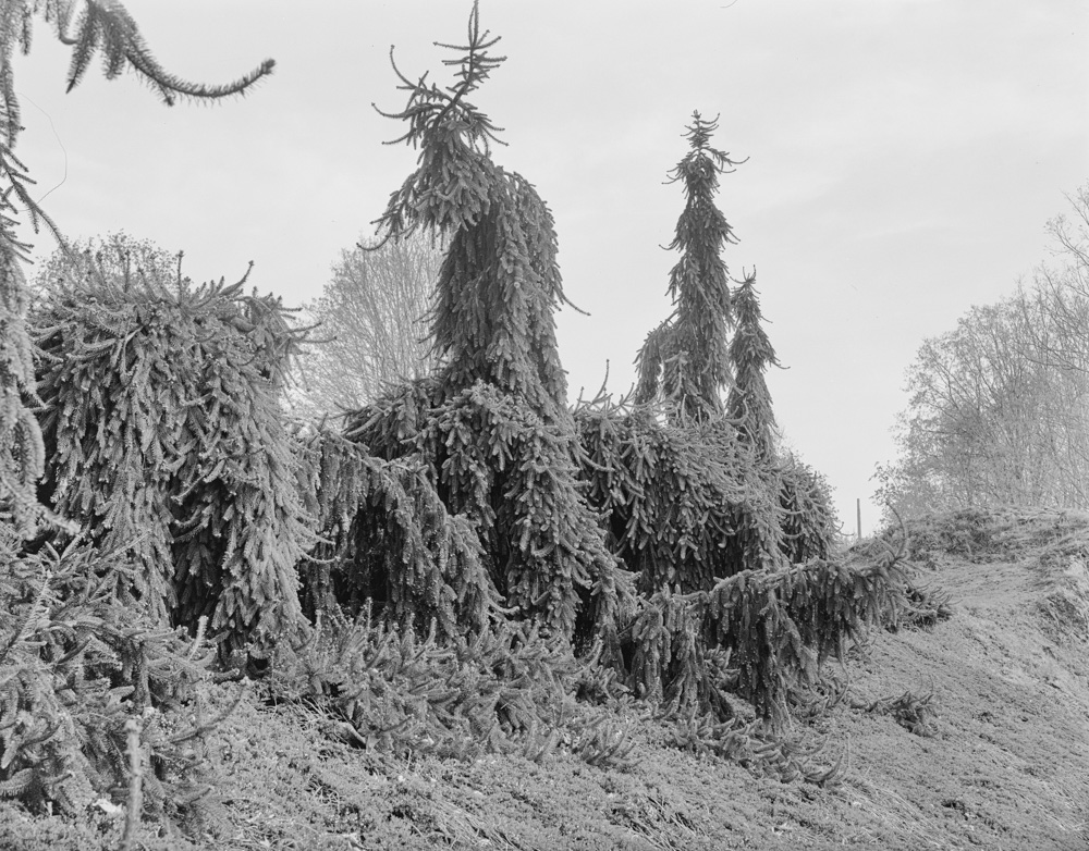
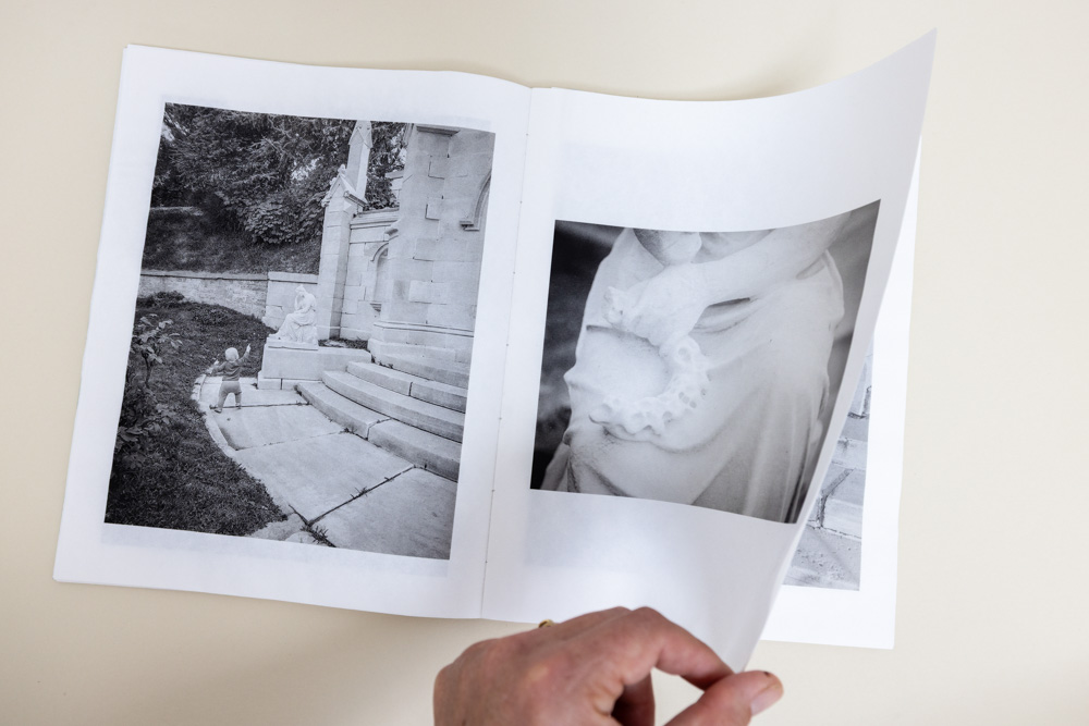
Weeping European Beech Baby Sleep Tonic is a lyrical memoir set primarily in Green-Wood Cemetery, a historic landmark and arboretum that became an unlikely refuge while raising a baby in a cramped city apartment. What began as desperate visits for greenery, fresh air, and quiet places to nurse evolved into a hunt for humor and surprise amidst the pathos of a grievous landscape. Reflecting on her child’s developing needs for silliness and play, Smith became drawn to the goofy weeping evergreens and whimsical stone carvings she found in the cemetery, as well as wasps’ nests and fleeting bird sightings. Meanwhile, they collected synthetic flowers found between gravesites, partially destroyed by maintenance equipment and time.
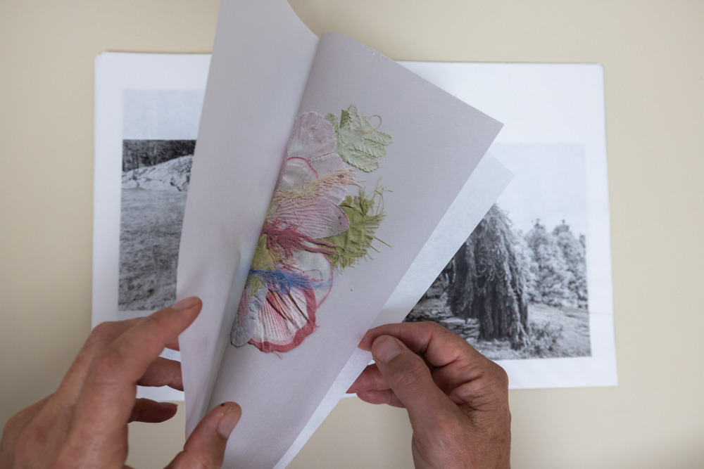
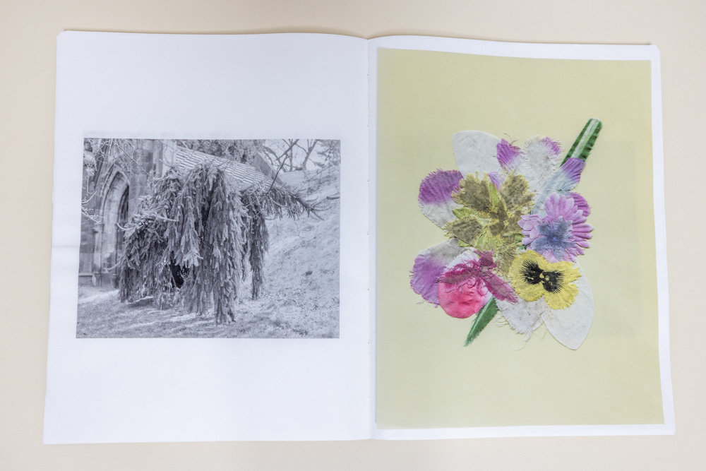
Detached color plates of collaged fake flower petals are tucked into the folds throughout the book, barely discernible through the photographic images printed on thin, transparent pages. They may go unnoticed, but when found, mimic the delight of stumbling upon an object holding a sentimental history of entropy, grief, and sunshine.
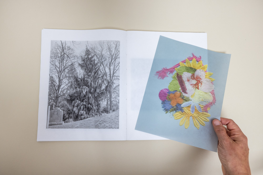
© Jennifer Lauren Smith, Weeping European Beech Baby Tonic
AS: Congratulations on finishing this gorgeous book! Can you tell me a little about the origins of the work?
JLS: The process of making this object began ten years ago, when I was raising a baby in a small apartment in Sunset Park. We spent our days wandering through the gargantuan cemetery across the street, Green-Wood, gluttons for nature and fresh air, always seeking quiet places to play. When my daughter began to toddle, she developed an urge to collect objects, and we filled our pockets with dirty synthetic flower fragments we’d find between the graves. They were talismans, little treasures. It took me a while to figure out what to do with them.
Eventually, I began making collages with the flowers, scanning and printing them at body-scale, around 32 inches or so, thinking about the idea of an herbarium of pressed flowers. However, I worried their material history wouldn’t be explicit enough without context—would they read as cemetery flowers, or just generic fake ones? I wanted the source of the objects, and their threadbare patina of grief, to be clear. At that point, I looked back at my old digital and cellphone photos to consider how they might contextualize the collage work in book form, then decided to return to the cemetery (I left Brooklyn and moved upstate in 2018) to make new photographs with a view camera. The cemetery has changed a lot since I was pushing a stroller around in 2016— my favorite broken mausoleum statuary has been repaired, and weeping spruces that once seemed humorously dog-like are now more amorphous. It was interesting to go back and make new images informed by my past life as a cemetery flâneur.
I wanted to keep the book loose and adventurous, like a field journal of both our cemetery days and of my own as a new parent. In the end, I used a combination of cellphone images, DSLR, and 4×5.

© Jennifer Lauren Smith, Weeping European Beech Baby Tonic
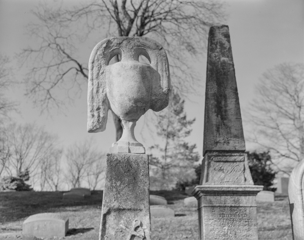
© Jennifer Lauren Smith, Weeping European Beech Baby Tonic
AS: It’s interesting that the genesis of the book was to contextualize the flowers, and that these collages were your first artistic response to that specific time and place in your life. And then with the distance of time, you return to make work again.
While there is a flower collage on the cover, you don’t encounter another for a while…maybe 11 photographs later? And it’s hidden in the folding of the pages! Can you tell me a little more about your choice to hide the collages and how you constructed the book to do this?
JLS: I structure many of my projects around an encounter, or a physical memory. I’m interested in the experience of stumbling upon something, as if fatalistically, and I make work in response to my urge to hold onto the magic of unique, embodied processes. What are the ways we remember our being in the world? What is specific to our perceptual experience? For me, one way to do this is by combining collected objects with photography. By tucking the color plates into the folds of black and white printed photographs, I aim to recreate the joy of discovering something unexpectedly. They appear later in the sequence so that I could build toward them in time.
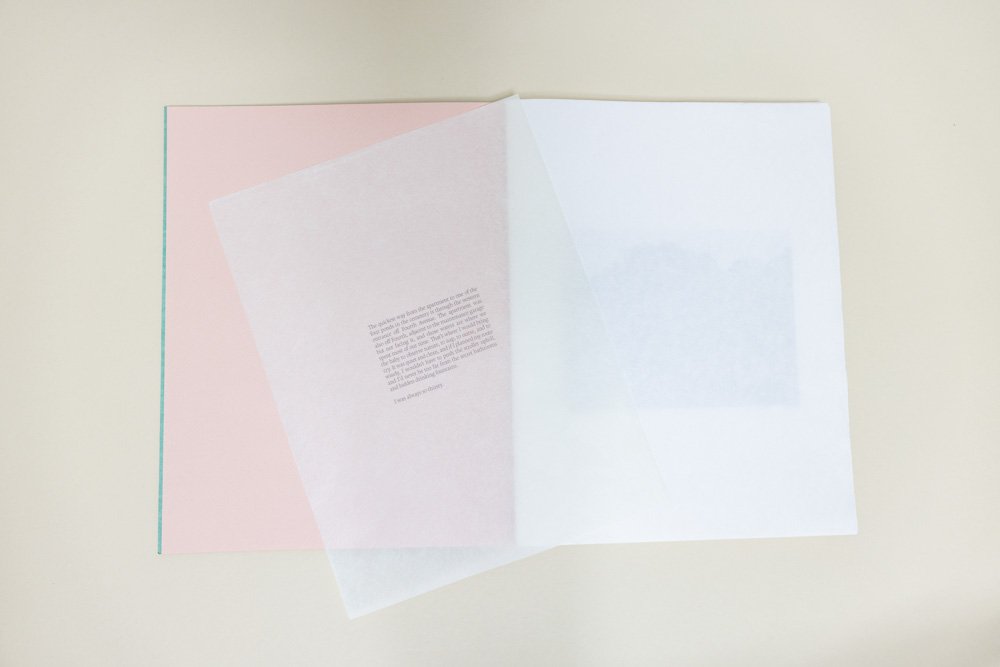
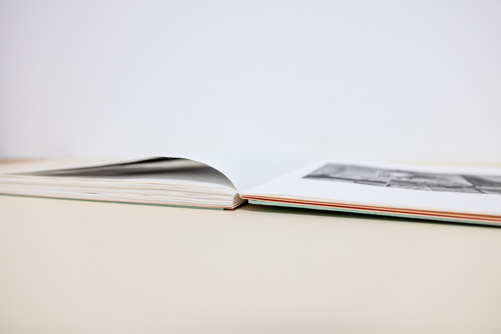
The collages and the text piece are slightly visible through the thin washi pages, ghost-like, and free-floating. I love how the text page is obscured at the beginning, much like how old headstones become difficult to read as they wear away. You can take the hidden pages out from the book and handle them, much like a pressed flower or a bit of ephemera you’d find in an old tome. Keeping the plates detached from the binding also reflects the tactile experience of finding these little fragments in the earth while rambling through the landscape. I chose a french fold with an open-flat hand-sewn binding to ease the management of the various loose sheets and underscore the tactility inherent in the book’s content.
© Jennifer Lauren Smith, Weeping European Beech Baby Tonic
© Jennifer Lauren Smith, Weeping European Beech Baby Tonic
AS: The sensory experience evoked by handling your book is perhaps my favorite part. The photographs are gorgeously printed on such delicate paper – the collages appear almost three dimensional. You have to be very careful when extracting the collages from the folds, and I’ll be honest, I’m a little afraid of damaging the paper! The construction of the book demands care and patience in order to experience the work, and it is a bit precarious, which at least for me, resonates with the experience of parenting, specifically motherhood. How do you see your role as a mother influencing your artistic practice, and did you have any hesitations about portraying this intimate part of your life in your book?
JLS: Manipulable parts can feel overwhelming; as a viewer, you’re suddenly thrust into the responsibility of taking care of the loose, flyaway elements. And you’re right – this fits well with a book generated from the experience of caregiving. I was careful to choose durable materials to pull this off. Washi paper is deceptively strong due to the long kozo (mulberry) fibers – even at such light weights – along with the Coptic stitching with thick waxed linen thread on the binding and archival book boards.
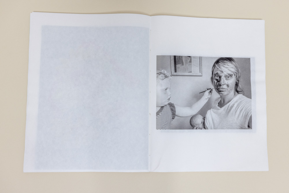
As for hesitation—absolutely! I am a lot more comfortable working through metaphor and material semiotics than through direct autobiography. I didn’t want this to read as a sentimental baby book, and I was genuinely worried about that. But I think the cemetery gave me enough distance and strangeness as a subject that I could approach motherhood sideways, by focusing on the zoomorphic trees, wildlife, and mausoleums I was photographing. That indirection let me be honest about the experience without feeling exposed or guilty of navel-gazing. The book isn’t really “about” my kids or me—it’s about the condition of monotony and hypervigilance that motherhood imposed, and I happened to be frequenting a cemetery when it happened. During my editing process, I was constantly adjusting the dials on what read as too personal and what felt too formal or generic. In the end I asked myself, “If you can’t be honest, what are you even doing?” and decided to include the selfie of one child painting my face while I nursed another. The indoor images are there to describe the circumstance of a cramped apartment set against the outdoor option, which happened to be a rolling landscape of death.

© Jennifer Lauren Smith, Weeping European Beech Baby Tonic
© Jennifer Lauren Smith, Weeping European Beech Baby Tonic
AS: I’ve been thinking about this “strangeness” of the cemetery (or “rolling landscape of death” – love that description!) as a location but also a subject within the work. At the surface it feels like a contrast – head stones vs babies – but it’s actually not at all. As the caregiver of a young child you are acutely attuned to death, or at least the possibility of death, lurking at every uncovered outlet or gap in the railing. But in your work this presence of death is expressed so peacefully, so naturally, so playfully. I find it very moving.
Can you tell us about the title Weeping European Beech Baby Sleep Tonic?
JLS: That is such a sweet observation; thank you.
I interpret cemeteries as existing as much for the living as for the deceased. Did you know that many historical figures interred at Green-Wood bought their plots years before their deaths and used them as places to gather for picnics and parties? A famous example is the 19th c. theater impresario William Niblo’s mausoleum – he used his plot as an extension of his entertainment complex, staging risqué, carnivalesque evenings on the grounds of his tomb. Green-Wood has recently begun spectacularly reimagining these evenings with fire-eaters, circus performances etc… it sells out every year! My point being, the playful energy continues to emanate for sure.
Anyway, as an artist, I’m so often drawn to these somber, poetic subjects, but pretty quickly I start looking for where the fun is; where’s the soft spot to be silly? I work to express the two-sidedness of things. As the cemetery became a playground for my growing toddler– I know it is ironic to raise a baby in a cemetery– it made sense that my photographs depict whimsical forms and playful moments found in the landscape. It’s both grievous and joyful.
Regarding the title of my book, it is important to emphasize that Green-Wood is also a 500-acre arboretum. To keep my mind engaged during those long hours and days, I began identifying the trees binomially, and started to organize time based on when things bloomed. I think about this quote in Hamnet a lot:
It is mid-May. Sunlight brightens the ground in glancing, shifting shapes; Agnes notices, despite everything, because she cannot not notice such things, what is flowering along the verges. Valerian, campion, dog rose, wood sorrel, wild garlic, river flags. Any other time, she would be on her hands and knees, plucking their heads and blooms. Not today.
– Maggie O’Farrell, Hamnet (pp. 129-130)
I relate so much to this idea of a mother who cannot not notice, both as a naturalist and as a caregiver: the vigilance that comes with parenting transfers so easily to the vigilance you experience when becoming attuned to horticulture.
There is a giant Fagus sylvatica ‘Pendula’ or Weeping European Beech on Oak Nut Path with a tunnel cut through it. I’d rock Pippa to sleep beneath that tree regularly, thinking of the tree’s energy as a special sleep tonic. The sort of breathless mouthful of the words all shoved together in the title also references the way, when caring for a small person, you are so often jumbled, rushing to meet a child’s need, prioritizing naps and feeding over your own thirst. I tried to continue to communicate this intensity in the prologue.
© Jennifer Lauren Smith, Weeping European Beech Baby Tonic
© Jennifer Lauren Smith, Weeping European Beech Baby Tonic
AS: I am curious about your experience self-publishing. How did you come to this decision? Do you have any advice for others embarking on similar projects?
JLS: This object is an extremely handmade thing; it is almost foolishly laborious. What I lack in patience for computer work and graphic design, I make up for in my willingness to make things by hand. In Penumbra’s Long Term Program, we were fortunate to have Paula McCartney as a visiting artist, and I subsequently took her 6-week course at Penumbra. It was so empowering and I learned so much. She breaks the process down into basic, manageable parts. That would be my first piece of advice for anyone interested in hand-made books: take a class with Paula!
No matter what, you’ll learn as you go. I knew I wanted to avoid double-sided printing on the washi paper I’d chosen, so I used that constraint to my advantage by opting for a French fold, which had the added bonus of creating a pocket. There are four color plates, one text piece, and the acknowledgments hidden in the pockets throughout the book.
I outsourced the printing to my friend Jackson at the CPW Lab in Kingston, NY, then did the folding and binding myself, choosing a Coptic link stitch that I found strong, beautiful, and time-tested. I hand-debossed the covers to inset the image, and my husband laser-engraved the title into the back covers. Then I used a drum-leaf technique to join the covers to the text block and complete the object. I made an edition of 15, plus 2 APs for handling at fairs or museum exhibitions.
© Jennifer Lauren Smith, Weeping European Beech Baby Tonic
© Jennifer Lauren Smith, Weeping European Beech Baby Tonic
© Jennifer Lauren Smith, Weeping European Beech Baby Tonic
AS: The result of your labor is stunning, it’s a very special book. Thank you so much for your time and sharing with us!
Weeping European Beech Baby Sleep Tonic is available from Jennifer Lauren Smith’s website.
Instagram: @jenniferlaurensmith, @amandajsauer
Posts on Lenscratch may not be reproduced without the permission of the Lenscratch staff and the photographer.
Posts on Lenscratch may not be reproduced without the permission of the Lenscratch staff and the photographer.
Recommended
-
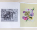
Jennifer Lauren Smith in conversation with Amanda SauerOctober 25th, 2026
-
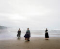
Bego Antón: All of Them WitchesOctober 15th, 2026
-
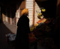
Stephanie Duprie Routh: The Atlas of ThingsOctober 13th, 2026
-
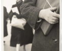
John Baer: The Extraordinary Ordinary: A Memoir in Photographs, 1945–1954October 12th, 2026
-
Nata Drachinskaya: BINOMOctober 6th, 2026