Jeff Rich: States Project: Iowa
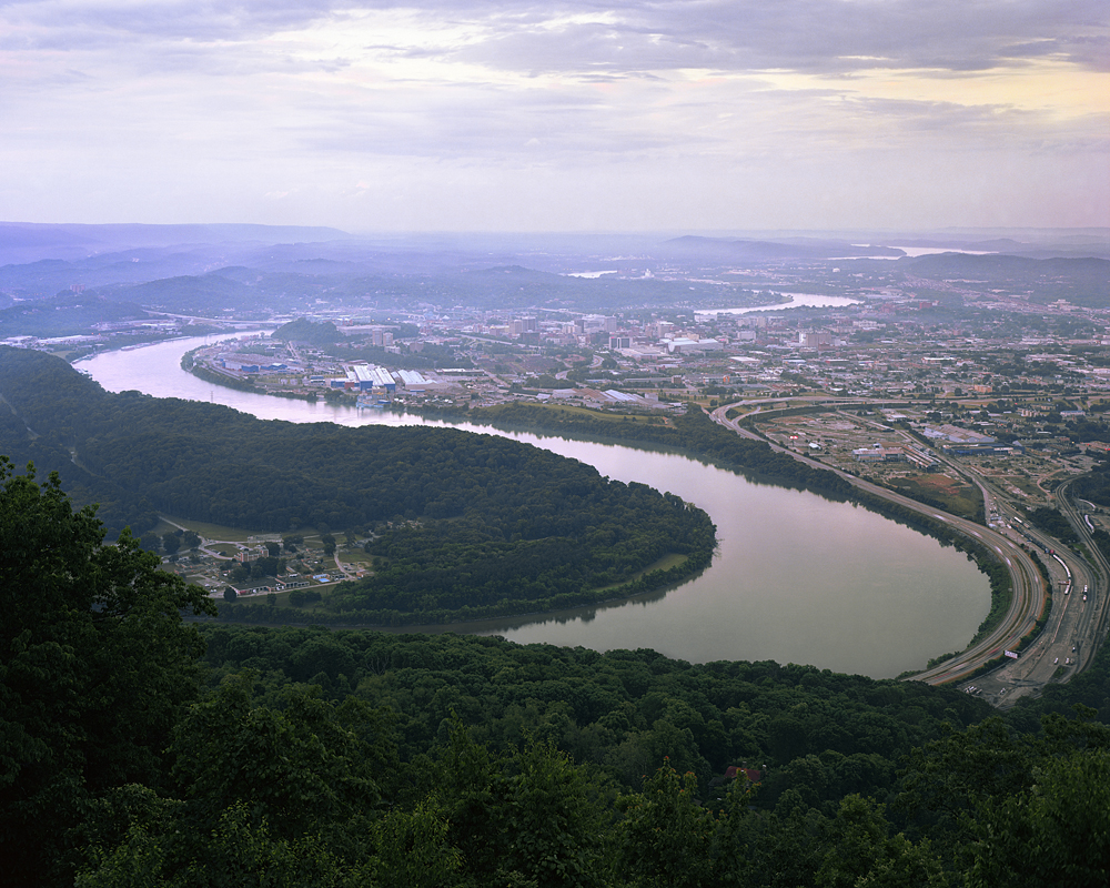
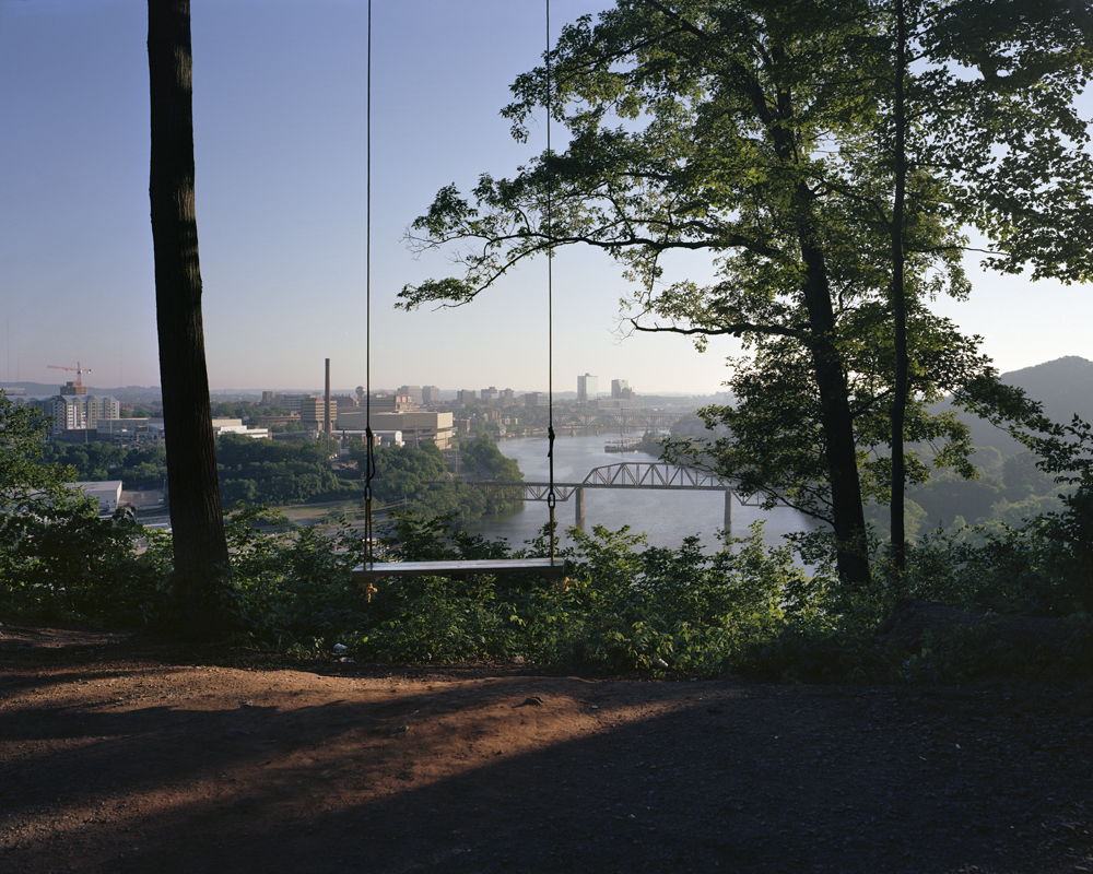
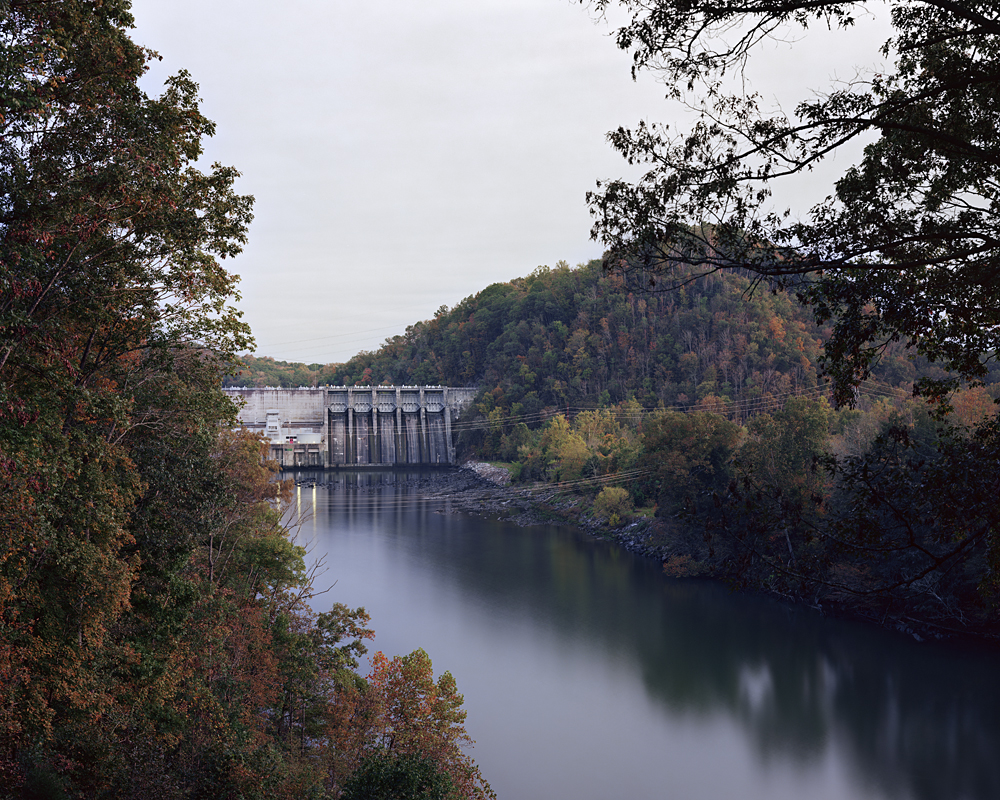
©Jeff Rich, Cattanooga Overlook, Because of constant flooding during the 19th and early 20th century, the TVA created a system of dams and reservoirs to protect the cities of The Tennessee Valley. Chattanooga, Tennessee is one of the top operating priorities of the agency. View of Chattanooga and The Tennessee River from Lookout Mounting facing northeast, 2015
Jeff Rich is a photographer’s photographer, consistently creating meaningful bodies of work that are powerful documentations and examinations of rivers and waterways in America. His stunning capture draws us in to discover the significant narrative to his projects. Jeff’s work focuses on water issues ranging from recreation and sustainability to exploitation and abuse. He explores these subjects by using long-term photographic documentations of very specific regions of the United States.We are thrilled that Jeff is this week’s Iowa States Project Editor, and appreciate his time and efforts during a period with much on his plate. An interview with Jeff follows.
Jeff has an exhibition of The Watershed Project at The John C. Hutcheson Gallery at Lipscomb University in Nashville, TN that runs from October 2-29. Jeff will host a talk in the Hutcheson Gallery at 6 p.m. on Monday, Oct. 5 with a reception to follow. He also has aligned with Fall Line Press in Atlanta to publish his Tennessee River work next fall.
Jeff received his MFA in photography at the Savannah College of Art and Design in Savannah, Georgia. Jeff’s project Watershed: A Survey of The French Broad River Basin was awarded the 2010 Critical Mass Book Award and was published as a monograph in 2012. His work has been featured on Flak Photo and as one of Daylight Magazine’s monthly podcasts, and has been exhibited internationally. In 2011, Jeff was named one of the winners of the Magenta Flash Forward Emerging Photographers Competition. Jeff Rich is an Assistant Professor at the University of Iowa, in the Art and Art History Department. He also curates the weekly series Eyes on the South for Oxford American Magazine.
![]()
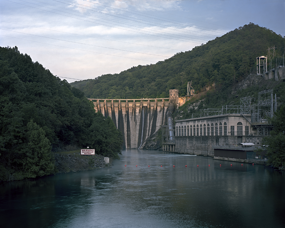
©Jeff Rich, Cheoh Dam, Little Tennessee River, Graham County, North Carolina, 2014
Watershed: The TVA and the Tennessee River
This work documents the heavily controlled and harnessed rivers of the Tennessee River Basin after 80 years of the Tennessee Valley Authority’s policies, ultimately showing the complicated effects and consequences of rapid large-scale modernization. The Tennessee Valley Authority (TVA) was the first modernization project of its kind in the world. It is also the only government agency whose limits are defined by a geomorphological condition: The boundaries of the Tennessee Watershed.
The project forms the second phase of The Watershed Project, which highlights the relationship between land, water, and man within the Mississippi River Basin. The project incorporates archival photography from the early history of the TVA as well as contemporary photographic documentation of TVA sites and the residents of the watershed.
The Tennessee River Basin is a system of rivers that sits in the heart of the South. Covering portions of seven states, this project traces the path of the rivers from the prominent dams and vistas of Appalachia, though the Tennessee Valley to the industrial landscapes of the Cumberland Plateau, and ending at the Ohio River. This path reveals how 80 years of the TVA, the New Deal era government organization created as a multipurpose agency to provide flood relief and produce electric power, as well as spur economic development through agricultural programs, has ultimately changed the nature of the Basin. The rivers of the Tennessee Watershed, once unpredictable and wild, have been developed into controlled reservoirs ready for recreation, commercial barge navigation, and power production.
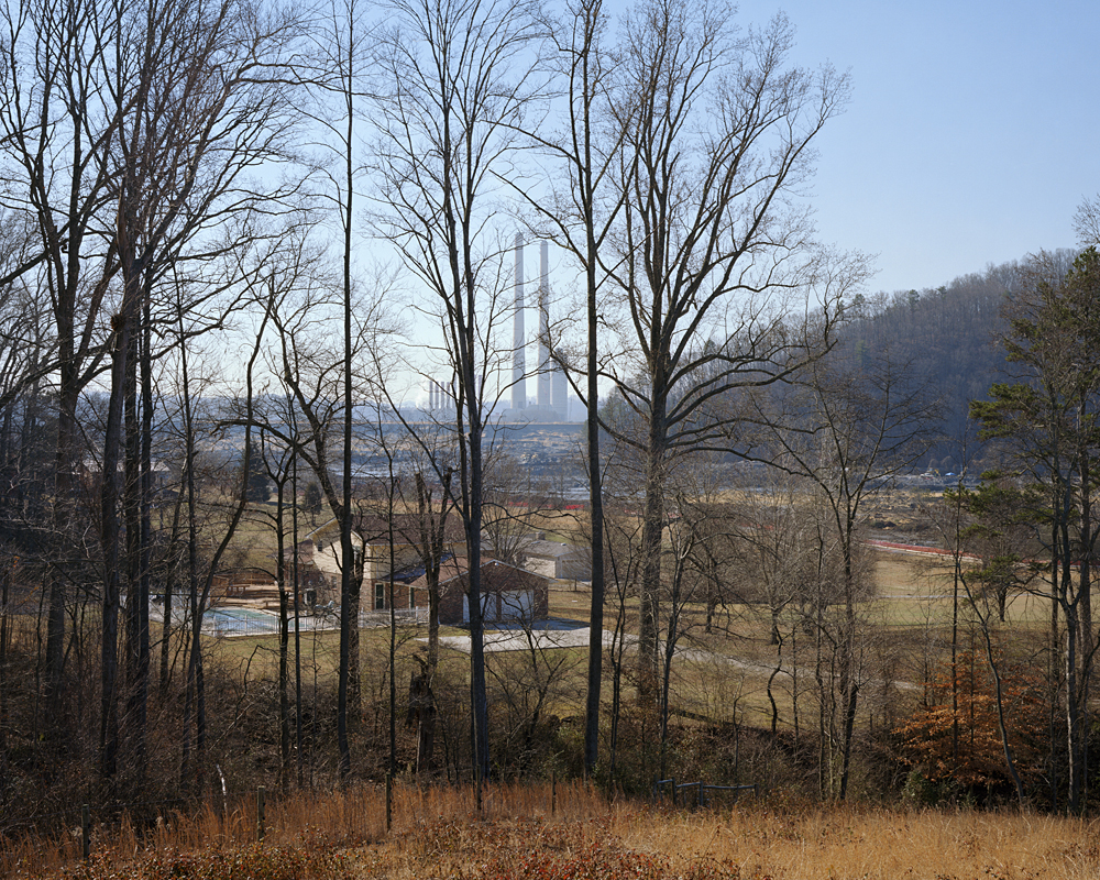
©Jeff Rich, Coal Ash Spill, On the morning of December 22, 2008, at the Kingston Fossil Plant, a dyke of a containment pond ruptured and, as a result, 5.4 million cubic yards of coal fly ash was released into the surrounding countryside. The nearby Emory and Clinch rivers were also inundated with the fly ash, which is a byproduct of coal burning power plants. This was the largest fly ash spill in US history. The EPA originally estimated that it would take six months to clean up the spill. As of May 2015, the cleanup continues. Kingston Fossil Plant, Harriman, Tennessee, 2009
As the current operator of 29 hydroelectric dams in the Tennessee Watershed, 18 power plants, and three nuclear plants, the TVA has a significant impact on the region. Its original mission as a multipurpose authority has shifted since World War II, and for the second half of the 20th century the TVA was mostly concerned with the production of cheap electricity through coal-fired power plants. However, its recent push towards heavier reliance on natural gas and nuclear energy, as well as renewable resources has changed the landscape of the rivers in the watershed in ways that are already evident. Down from being one of the top five most polluted rivers in the United States in the 1990s, the Tennessee now sits near the bottom of the list of 25 most polluted rivers. However, alongside this progress, there have been negative reverberations throughout the watershed communities. From the drowned towns and resident relocations spanning the 20th century to the largest toxic waste spill in US History in 2008, the TVA’s effect on the region is all encompassing.
The TVA can be seen as a precursor to many current large scale hydroelectric and modernization projects. Currently, there are 50,000 large dams built worldwide, 90 percent of them built since 1950. The early successes of the TVA were an inspiration for this dam building frenzy. By examining the motivations for the creation of the TVA as well as the outcomes in the 21st century, this project offers a rare glimpse into 80+ years of the history of a highly influential regional planning project.
©Jeff Rich, Ocoee Dam No. 1, Ocoee River, Tennessee, 2013
Can you tell us a bit about your experiences growing up and how they shaped the work you make today?
I grew up in Satellite Beach, Florida, a beach town about 15 miles from Kennedy Space Center. Growing up in a place like this, I think a few things were pivotal in forming my perception of the world. One was growing up on the water with access to a canoe, I was constantly going out into nature to explore; I’d regularly see Manatees, Bottlenose Dolphins, Bald Eagles, Ospreys, Brown Pelicans, Anhinga, and may other seemingly exotic (or endangered) species. Another was witnessing the effects of development and pollution on that nature. New housing developments, pollution from runoff and leaky septic tanks made the water in my canal a disturbing bright green color during the summer months. Not to mention rumors of Air Force dumping toxic chemicals and a local cancer cluster.
Also being so close to the Space Center, I was lucky enough to see the Space Shuttle launch at least 75 times while I lived in Florida. Actually one of my favorite places to visit as a kid was the Merritt Island Wildlife Refuge, which was right next to the Space Center. I think the exposure to not only nature on a daily basis, but the advanced research happening nearby has really made me curious about land use and conservation.
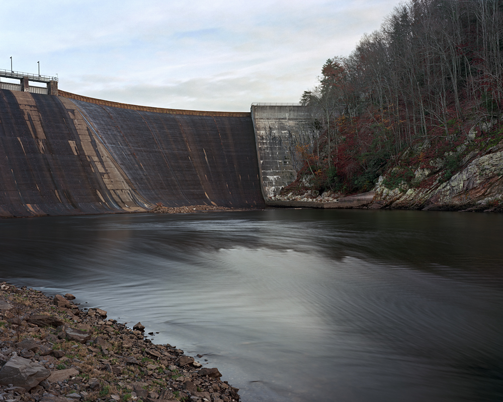
©Jeff Rich, Tellico, The finding of a rare fish, the Snail Darter, in The Little Tennessee River stopped work on TVA’s Tellico Dam in 1973. The construction was delayed by a lawsuit brought by opponents of the Dam under the Endangered Species Act. After a lengthy legal battle, the US Supreme Court upheld the injunction in the landmark case TVA v. Hill. However in 1979, the dam was completed because of an exemption made by the US Congress. Tellico Dam, 2015
Your work has the ability to transcend traditional documentary photography, where the sumptuousness of your capture draws us in to discover something darker. The juxtaposition of beauty with destructive overtones makes the photographs so powerful. Before we speak about subject matter, let’s talk about light. Your work feels incredibly painterly and the quality of light so important to your story telling.
Yes, lighting is very important to convey the mood of my work. This probably goes without saying, but I have a very difficult time taking a photo under full sun at noon. I usually visit the sites near dawn or dusk to make the photographs, but sometimes will return at different times of day to see the effects of the light on the site. For me, these photographs need to be beautiful if only just to emphasize how most of these environmental issues are hidden in plain sight.
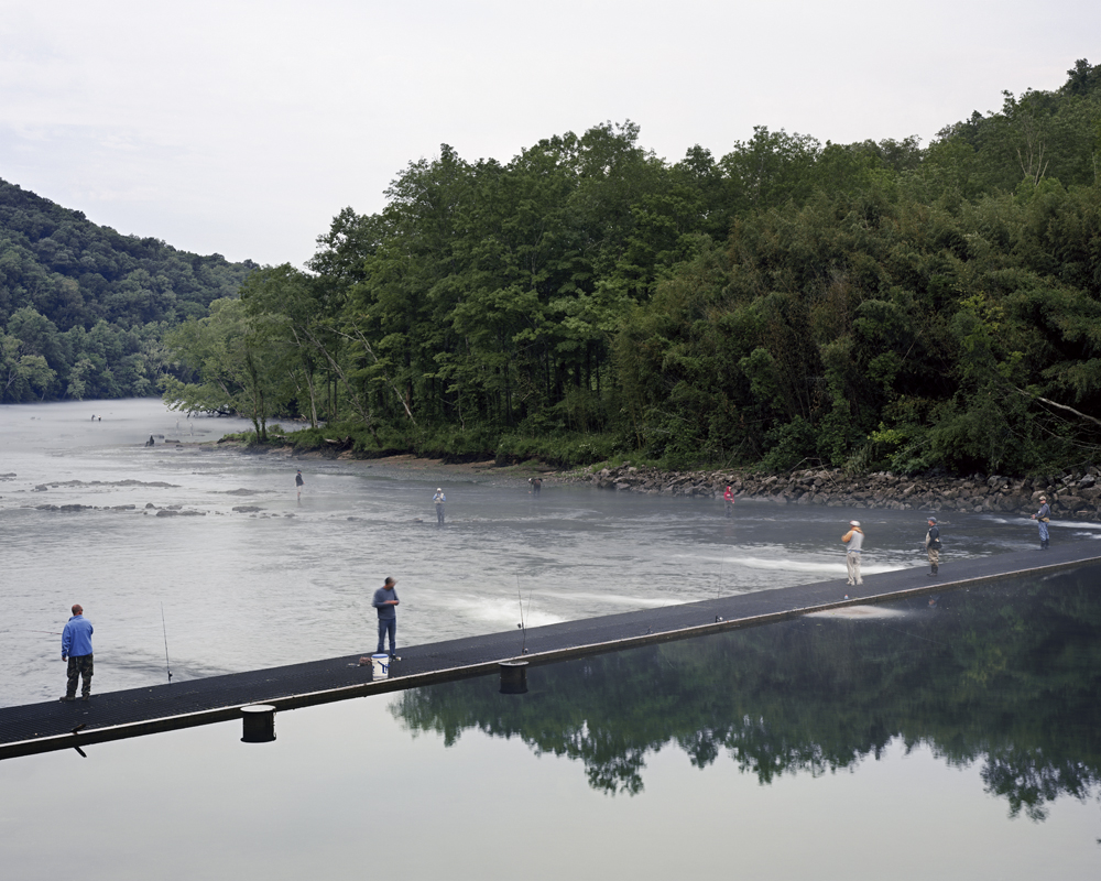
©Jeff Rich, Norris Weir, The Norris Weir Dam is used to reintroduce oxygen back into the river after it is depleted behind Norris Dam. Clinch River, 2014
Your projects are long-term, where the revisiting of subject matter allows for deeper considerations. Do you ever feel finished with a project or do you feel called to survey new bodies of water?
I never really feel finished with a project. One of the reasons I started the Watershed-Project.com website, is so I can keep track of all the sites I’ve visited and see how they change over time; my documentary images describe a view of the site taken at a specific time and place, while the satellite and aerial images (from Google) are regularly updated, demonstrating the changes happening on the landscape of the watershed.
I am considering a few projects here in Iowa. Two major rivers, The Missouri and The Mississippi, border Iowa and it is one of the most transformed states in terms of agricultural land use, so there is a lot of subject matter there.
©Jeff Rich, Knoxville Overlook,Downtown Knoxville, River Bluff Overlook facing Northeast, 2015
Today we are featuring The Watershed Project –The Tennessee with new work. How do you decide which body of water to return to and continue the series?
With the Tennessee Watershed work, I have found that I constantly re-evaluate my depiction of the complex relationship between The Tennessee Valley Authority and the rivers and people of the Watershed. So making the decision to return has been easy because I always feel the need to explore another aspect of that relationship. Most of my subject matter comes from researching particular sites in the watershed, which usually leads me to other sites and residents or organizations. Although, on my way down to the South, I cross over the Mississippi River, and sometimes it’s difficult not to just stop there and start shooting.
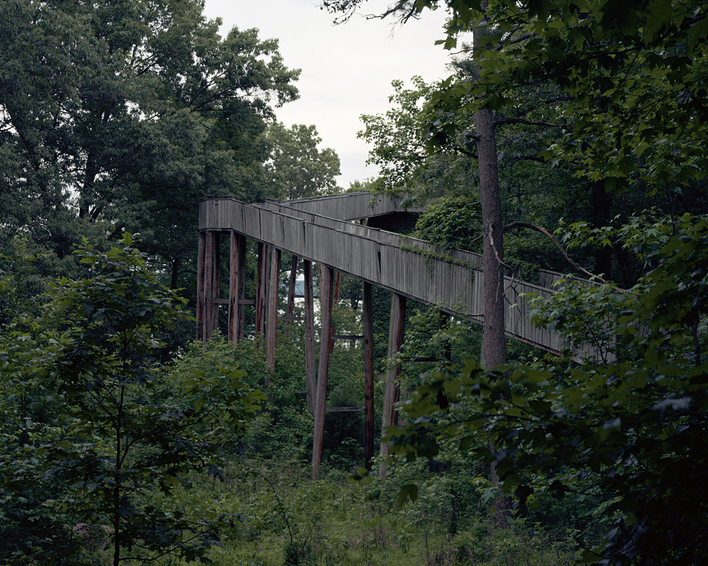
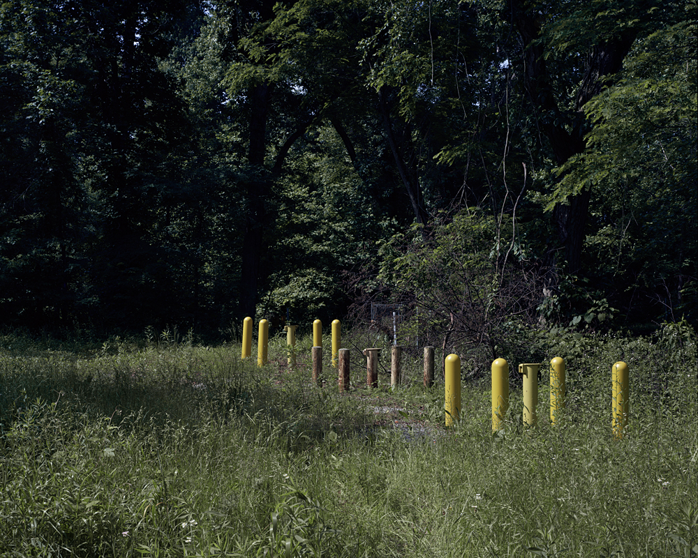
©Jeff Rich, Land Between the Lakes, Abandoned Overlook Ramp, Land Between the Lakes Recreation Area was created by the TVA in the 1960s as a multiuse recreation area, an example of the agency’s multipurpose mission. In 1998 after years of low attendance and several failed projects to attract visitors the TVA transferred operation of the park to The U.S. Forest Service
Your work has been well celebrated and has garnered numerous exhibitions and awards, but I have a feeling while all this is wonderful, it’s the work that has the most meaning for you, and it’s back to business as soon as possible.
Yes, I can’t wait to start working on the next project! Although getting this work out there in exhibitions and publications is really important as well. Discussing these issues and raising awareness, especially in the communities most affected, is essential to this works’ success. I am really excited to be exhibiting the Tennessee River work for the first time in a couple weeks at Lipscomb University in Nashville, Tennessee.
©Jeff Rich, Paducah Gaseous Diffusion, Monitoring Wells on Big Bayou Creek, downstream of the Paducah Gaseous Diffusion Plant (PGDP) a Uranium enrichment plant. These wells are designed to monitor the pollution of Big Bayou Creek. Because of spills and discharges into the creek from the PGDP, the creek is polluted with Ionizing radiation.
Did winning the 2010 Critical Mass Book Award change things for you?
Absolutely, it brought the work to an international audience. Winning the Book Award was a great honor and I can’t even begin to explore how many things it has changed for me, it was really a life changing moment. I would say that almost all of the honors and opportunities to share my work could be traced back to the award. One of the best things about the award was the chance to spend a lot of time working on, and producing the book itself. Working with Lauren Henkin on that process has changed the way I see my work, and I am truly grateful for that experience.
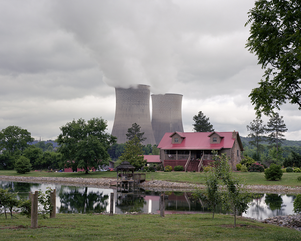
©Jeff Rich, Watts Bar Cabin, Watts Bar Nuclear Plant, TVA halted construction on Reactor #2 in 1985. However TVA plans to complete the reactor by December 2015, becoming the first US nuclear reactor to come online in the 21st Century. Tennessee River, 2015
How has being based in Iowa changed your image making? Are you still pulled to the South to make work?
Being in Iowa has changed my work in one major way, Research. Being at the University of Iowa, a top tier research institution, with access to great libraries, facilities, support staff, engaged colleagues, and an amazing Division of Sponsored Programs has made all of this work possible. It has also allowed me to focus on the research and creating the work. The South is still a big draw, mostly because the work on the Mississippi isn’t complete yet, but it is still one of my favorite places to make work.
©Jeff Rich, Boone Dam, Boone Dam started leaking in 2014, the foundation was found to have a sinkhole that was letting water seep under the dam. Repairs are estimated to take 5-7 years and cost nearly $300 million to complete. South Holston River, Sullivan County, Tennessee, 2012
What’s next?
The Mississippi River Basin is my next project. I am planning something a little bit different for this part of the Watershed project. I’m keeping it mostly under wraps at this point, but I’ll give you a hint as to the new direction. In such a large River Basin, there are so many directions to take the project I’ve had to zero in on very specific sites of interest.
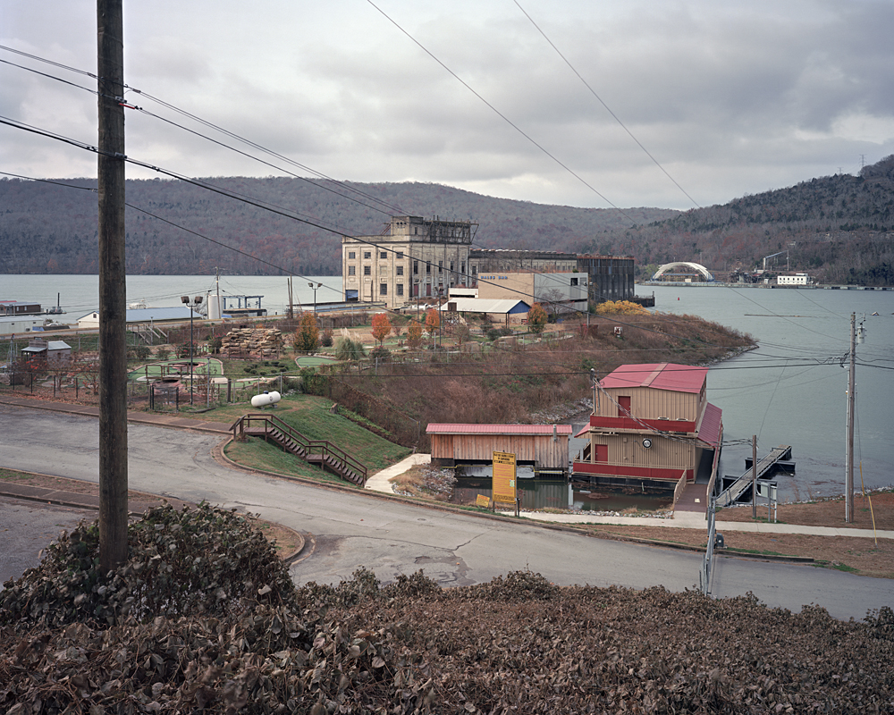
©Jeff Rich, Hales Bar, Hales Bar Dam was dismantled in 1968 because of an ongoing leak that originated in the faulty design and construction of the dam in 1913. The Tennessee River, Marion County, Tennessee
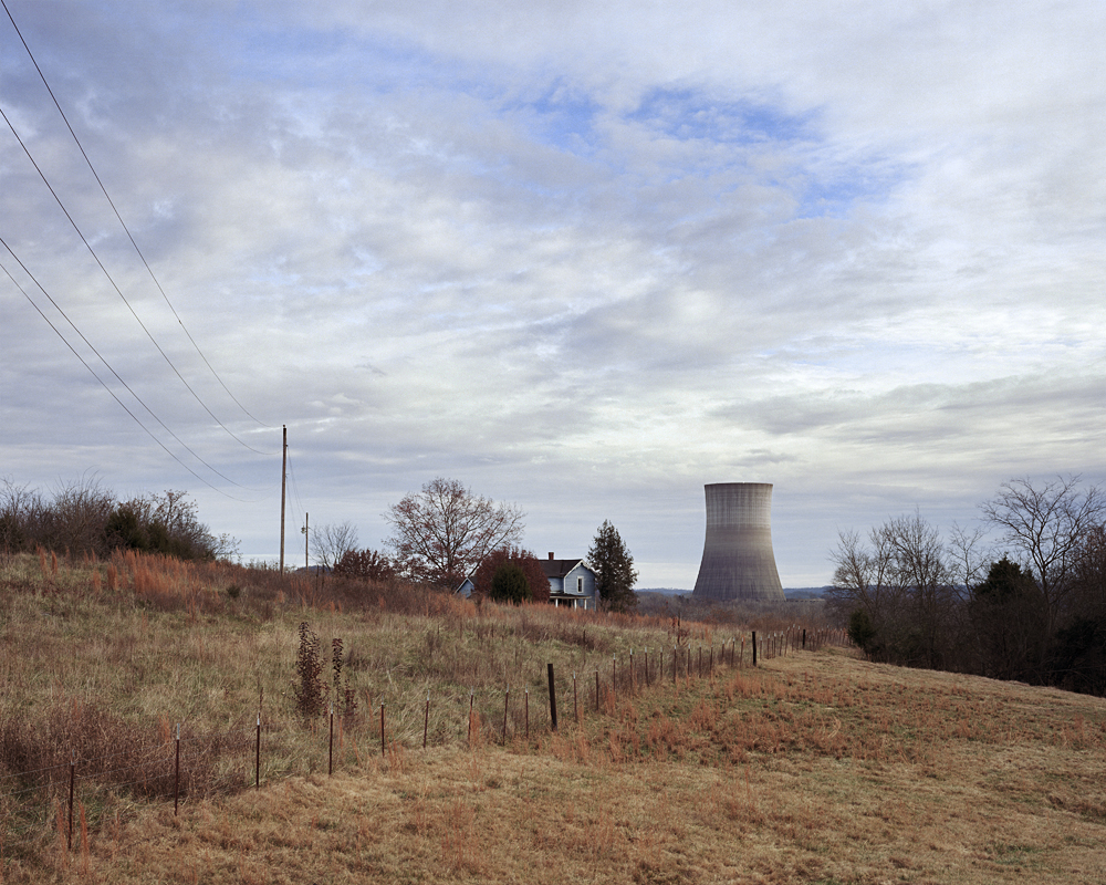
©Jeff Rich, Closed Plant House, Hartsville Nuclear Plant (Abandoned) Reactor construction canceled in 1984, Cumberland River, Hartsville, Tennessee, 2013
Posts on Lenscratch may not be reproduced without the permission of the Lenscratch staff and the photographer.
Recommended
-
Mitchell Squire in Conversation with Douglas BreaultMay 16th, 2023
-

Zora Murff: States Project: IowaOctober 3rd, 2015
-
Christine Carr: States Project: IowaOctober 2nd, 2015
-

Lindley Warren: States Project: IowaOctober 1st, 2015
-

Annick Sjobakken: States Project: IowaSeptember 29th, 2015


