Bruce Myren is one of those lucky individuals whose terrific Kickstarter project has been fully funded, and he still has a month still to go…but Bruce still needs funds to fully complete a fascinating body of work that looks at the Fortieth Parallel across the United States. It allows us to travel across the country in a straight line, and experience the landscape through Bruce’s exquisite lens. This is a significant documentation of our country and I hope you consider backing his efforts.
The idea for “The Fortieth Parallel” came to me while I was living in Boulder, Colorado in the 1990s. My friend Eric and I were sitting on top of Flagstaff Mountain gazing at the plains. I noticed that a road, Baseline Road, went east in a straight line towards the horizon. Eric explained that that particular road marked the 40th degree of north latitude and was the baseline for the surveying the Kansas and Nebraska Territory. At that moment, I knew I had a project: I was going to document the 40th parallel across the whole country, creating a new survey along this historic line.
Bruce lives in Cambridge, MA and holds a BFA in photography from the Massachusetts College of Art and Design and an MFA from the University of Connecticut, Storrs. He is deeply committed to education and is the current Chair of the Northeast Region of the Society for Photographic Education, as well as a Critic at the Rhode Island School of Design, Adjunct Faculty at the Art institute of Boston at Lesley University, and a Visiting Lecturer of Art at Amherst College. He had exhibited and been published widely.
Images from The Fortieth Parallel
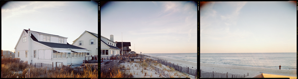
N 40° 00’ 00” W 74° 03’ 32” Normandy Beach, New Jersey, 1998
My work investigates issues of place and space and boundaries and borders through the exploration and employment of various locative systems. I am most interested in how macro systems relate to micro experiences of land and landscape. My recent series include an investigation of the Fortieth Parallel of latitude; a study of the poet Robert Francis’s one-person house in the woods of Amherst, Massachusetts; and a piece that documents the view from every place I have lived to where I live now.
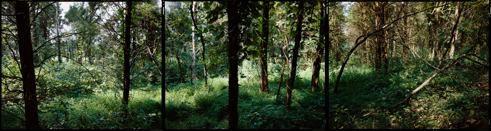
N 40° 00’ 00” W 77° 00’ 00” East Berlin, Pennsylvania, 2006
I am fascinated with location-based systems and my work engages the nature of how humans measure the world. I often use or create rules to govern the location or approach in order to make a series of photographs. This method stems from my interest in maps and mapping, historical photographic surveys, and conceptually-based art practices. It is through these influences that I started to see and make pictures: by measuring, coordinating, and locating myself within the world. Currently my work has been progressing from more universally recognized ideas of place towards more personal re-presentations.
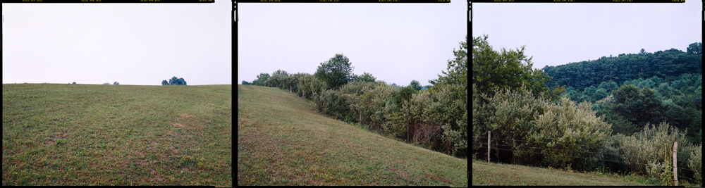
N 40° 00’ 00” W 78° 00’ 00” Harrisonville, Pennsylvania, 2006
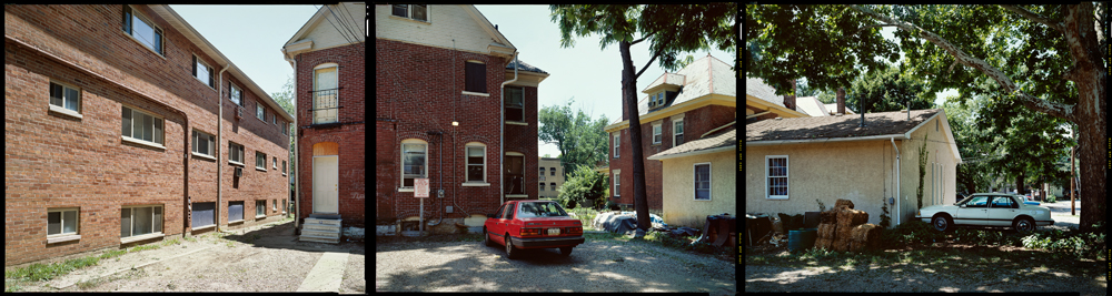
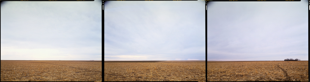
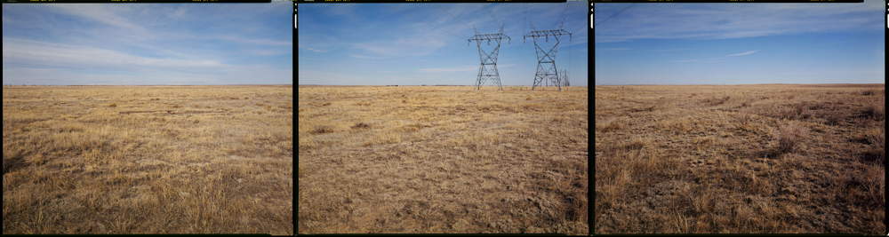
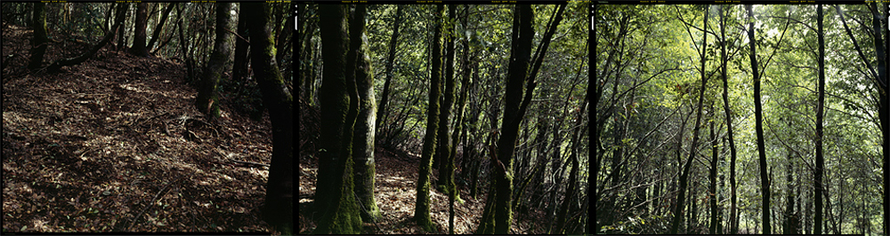
The Fortieth Parallel is a panoramic examination of precise yet arbitrary places found along this important parallel of latitude across the American landscape. Since 1998, I have been photographing the 40th degree of latitude across the United States at every whole of degree of longitude using a GPS. At each confluence, there is approximately a 20 square foot area in which I can compose a view.
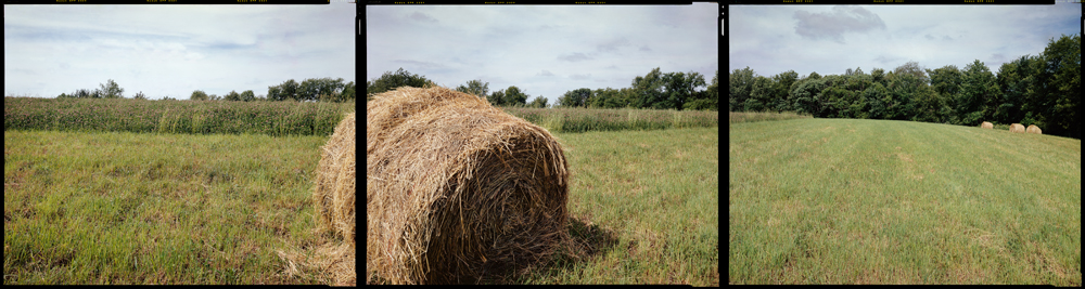
N 40° 00’ 00” W 79° 00’ 00” Somerset, Pennsylvania, 2006
This important baseline was used in surveying state boundaries and creating townships and homesteads, and was a key marker in particular for the settlement the West. I am interested in the relationship between the 19th century’s understanding and construction of landscape, location, and place and our 21st conceptions. There are 50 confluences on land, with 2 at landfall on each coast. To date, I have been to 32 of the 52 sites; in the June 2012, I launched a Kickstarter campaign to fund the finishing of the project.
N 40° 00’ 00” W 81° 00’ 00” Belmont, Ohio, 1999
N 40° 00’ 00” W 83° 00’ 00” Columbus, Ohio, 1999
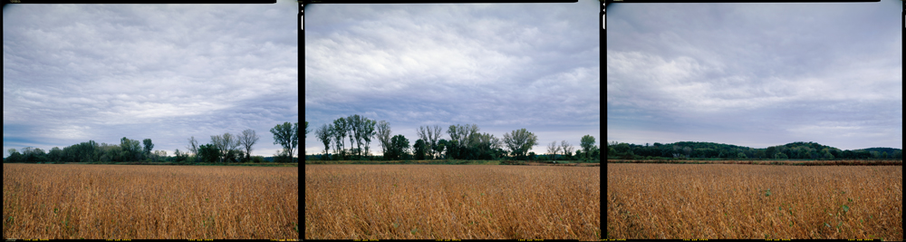
N 40° 00’ 00” W 95° 00’ 00” Fillmore, Missouri, 2007
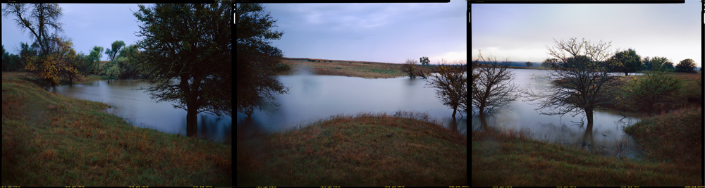
N 40° 00’ 00” W 97° 00’ 00” Hollenberg, Kansas, 2007
N 40° 00’ 00” W 98° 00’ 00” Webber, Kansas, 2007
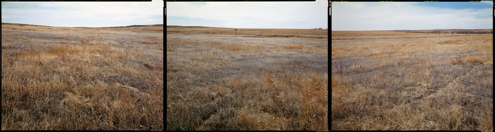
N 40° 00’ 00” W 102° 00’ 00” Saint Francis, Kansas, 2008
N 40° 00’ 00” W 103° 00’ 00” Otis, Colorado, 2008
N 40° 00’ 00” W 104° 00’ 00” Hoyt, Colorado, 2008
N 40° 00’ 00” W 105° 00’ 00” Broomfield, Colorado, 2008
N 40° 00’ 00” W 108° 00’ 00” Meeker, Colorado, 2000
N 40° 00’ 00” W 124° 00’ 00” Whitehorn, California, 2012


