Virginia McGee Richards: The Inner Passage: An Untold Story of Black Resistance Along A Southern Waterway
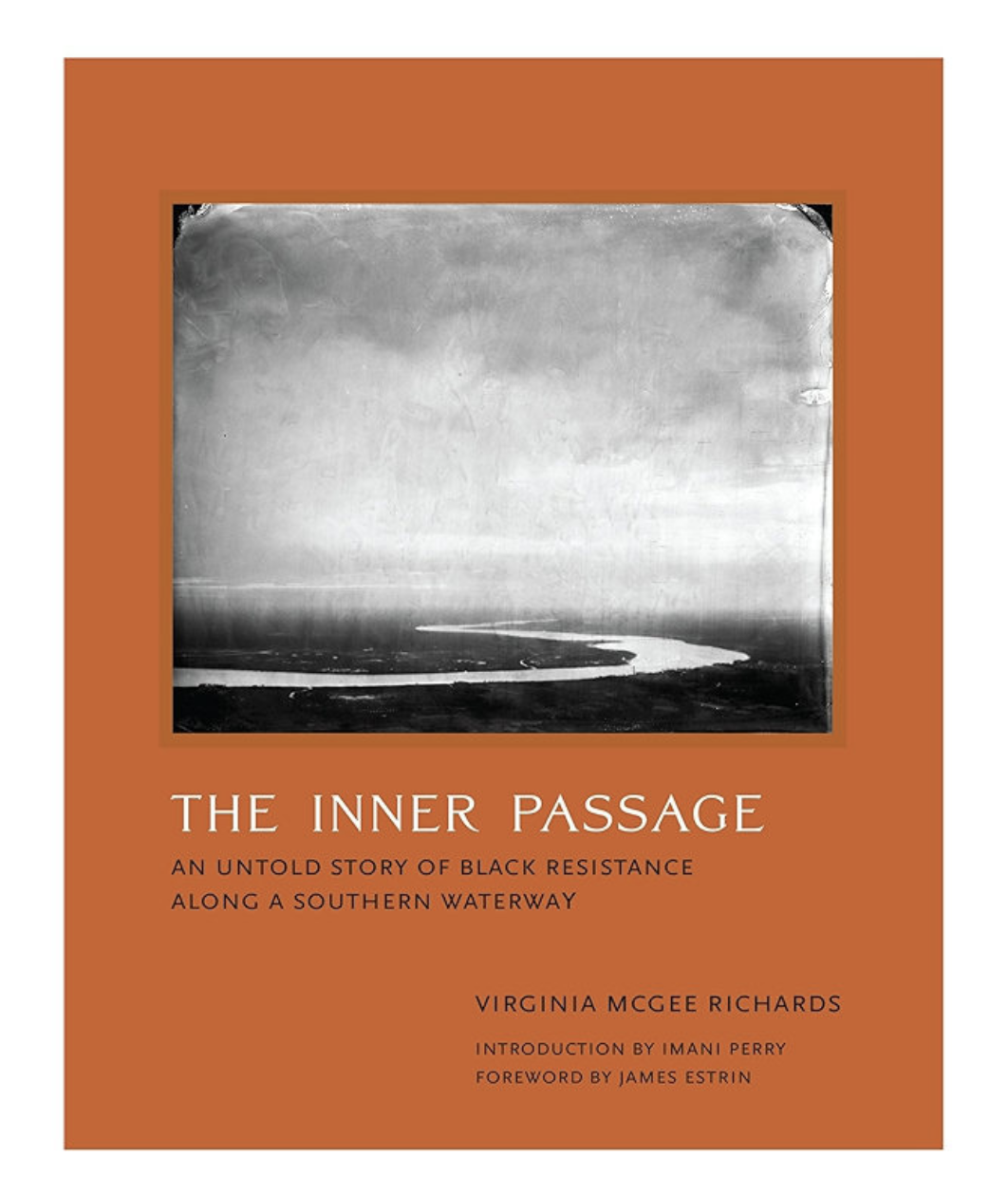
©Virgina McGee Richards, Book Cover of The Inner Passage: An Untold Story of Black Resistance Along A Southern Waterway, published by MIT PRESS
The Inner Passage: An Untold Story of Black Resistance Along A Southern Waterway by Virginia McGee Richards, published by The MIT Press, is a deeply considered photographic and historical exploration of the waterways known as the Inner Passage in the South Carolina Lowcountry. For many years, photography has served as an important tool for recovering histories that have been overlooked or intentionally forgotten, and Richards approaches this responsibility with remarkable care and attentiveness. Through photography, oral histories, environmental research, and personal reflection, she uncovers the largely untold story of canals constructed by enslaved Black men throughout the seventeenth and eighteenth centuries for mercantile shipping and plantation economies, but later used by enslaved people seeking freedom in Spanish Florida. Throughout the book, Richards demonstrates a commitment not only to understanding this history but also to understanding the people and landscapes that continue to carry it into the present. Her photographs and writing move beyond documentation alone, creating a thoughtful meditation on the responsibility of preserving histories that continue to shape contemporary life.
©Virgina McGee Richards, Spread from The Inner Passage: An Untold Story of Black Resistance Along A Southern Waterway, published by MIT PRESS
©Virgina McGee Richards, Spread from The Inner Passage: An Untold Story of Black Resistance Along A Southern Waterway, published by MIT PRESS
©Virgina McGee Richards, Spread from The Inner Passage: An Untold Story of Black Resistance Along A Southern Waterway, published by MIT PRESS
What makes the book especially compelling is the way Richards approaches the project with both historical rigor and deep care. Rather than documenting the waterways from a distance, she literally and figuratively immersed herself in the landscape to better understand the histories embedded within it. Her sixty photographs of descendants connected to the Inner Passage communities throughout the South Carolina Lowcountry, the Sea Islands, and Charleston feel grounded in trust and attentiveness, something made evident through her photographic methodology and the intimacy present within the portraits.
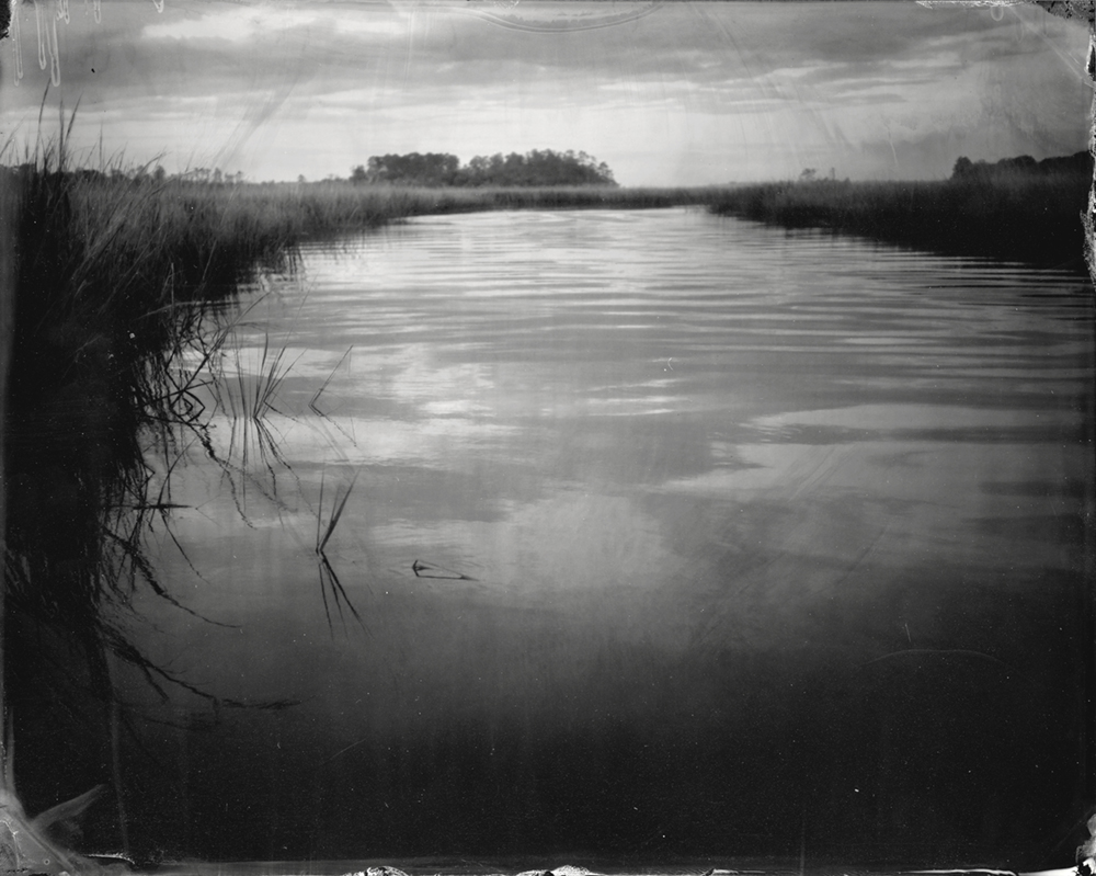
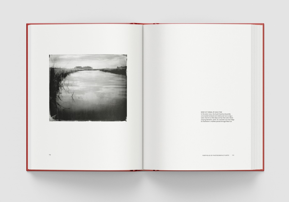
© Virginia McGee Richards, NEW CUT CANAL AT HIGH TIDE, In the early 1700s, the South Carolina Assembly conscripted enslaved and indentured men to dig a water channel six feet deep and ten feet wide. Boats carrying deerskins, pitch, tar, and later rice and indigo to Charleston’s markets passed through New Cut.
Photographer and author Virginia Richards first learned of the Inner Passage waterway over a decade ago while she was open-water swimming through New Cut canal. She regularly swims in Lowcountry canals and creeks after consulting tidal charts to make sure she is moving with the tidal current. The tides near Charleston move over five feet of ocean water to and from the ocean through inland creeks. In the 1700s and 1800s boats traveling through New Cut used the powerful incoming and outgoing semi-diurnal tides to propel them to and from Charleston.
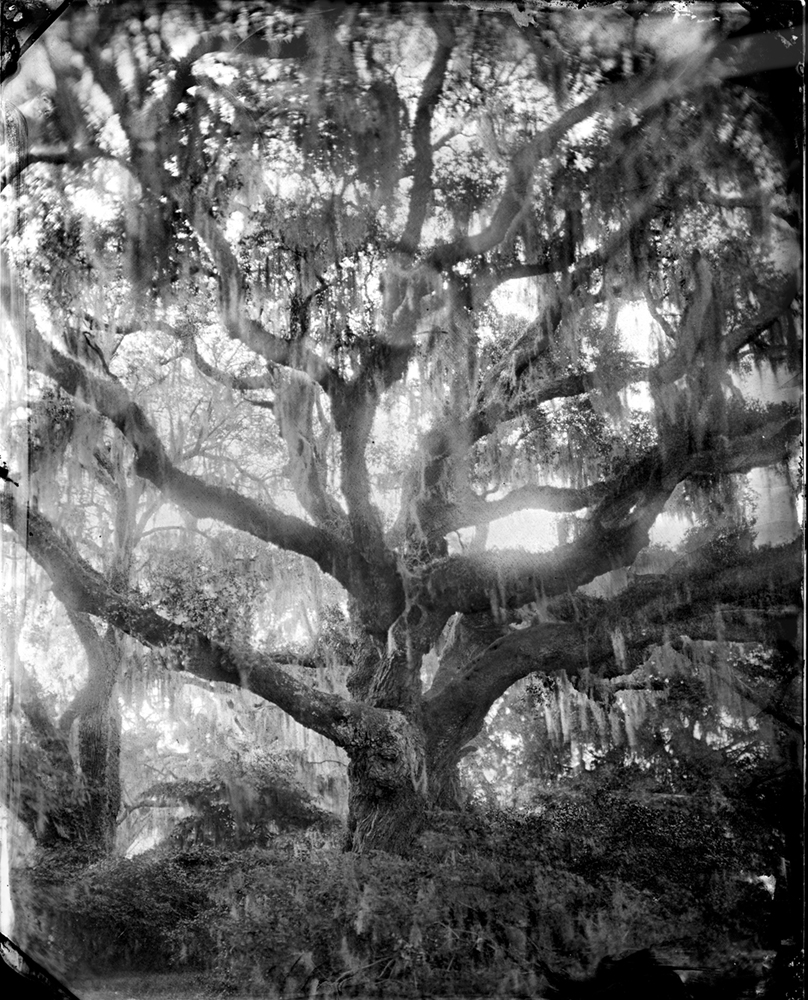
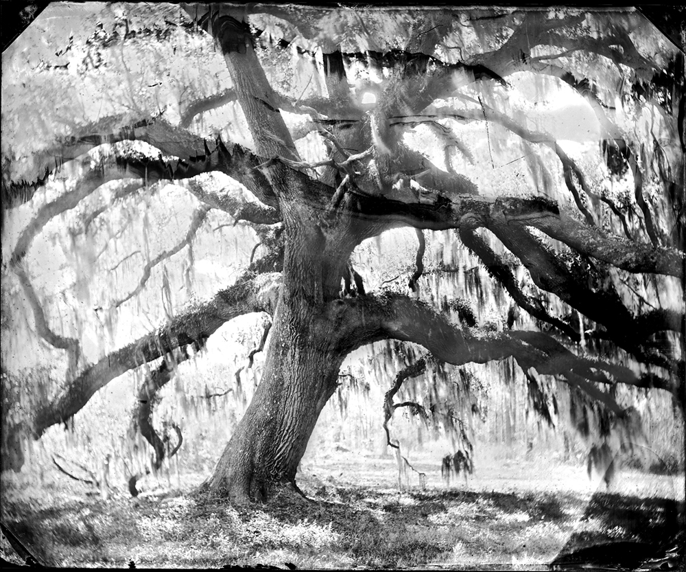
© Virginia McGee Richards, WITNESS TREE, WADMALAW ISLAND, Live oak tree, estimated to be over 300 years old, grows beside New Cut canal on the Inner Passage.
Metal buttons, old clay pipes and other personal objects dating back hundreds of years remain buried under this tree. The artifacts are from eighteenth and nineteenth-century travelers who waited under the tree for the ferry to Charleston. The New Cut ferry, which docked at the base of the tree, carried people and their farm produce over twenty miles from Wadmalaw Island to Charleston.
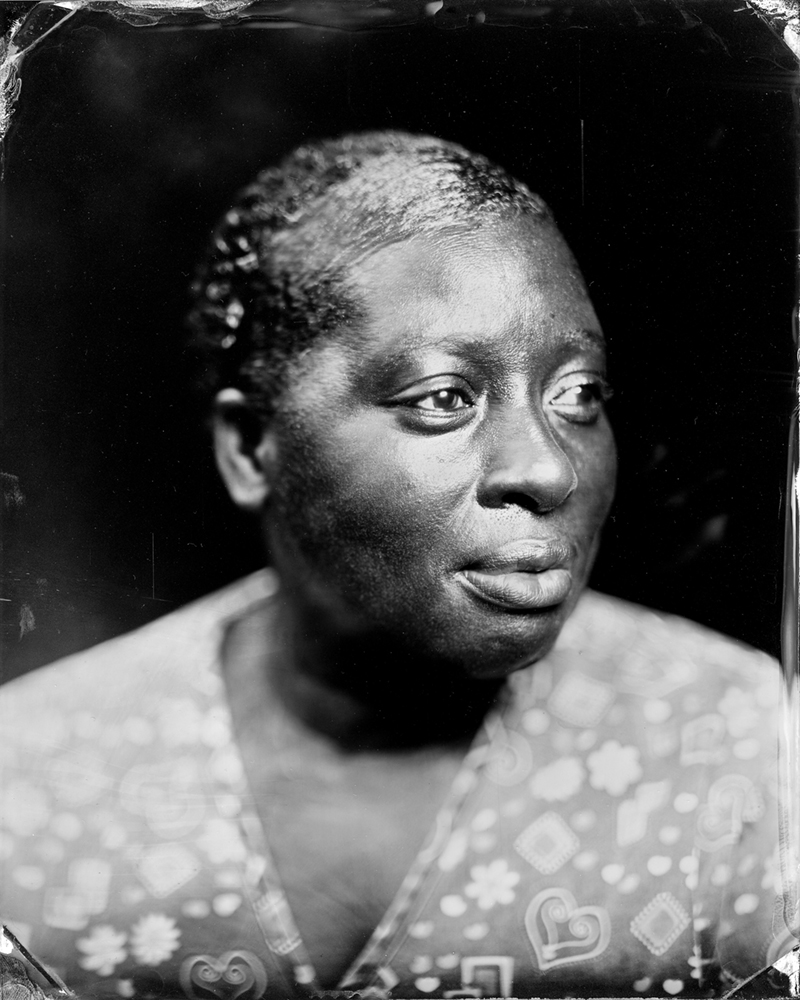
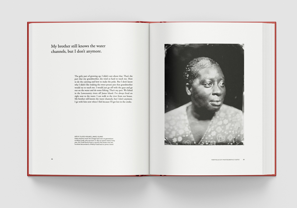
© Virginia McGee Richards, KATHY FLUDD HOLMES, JAMES ISLAND, Kathy Holmes traces her lineage in the Lowcountry to the early 1800s to a couple named Lazarus and Hester. Her ancestor, Molly Fludd, was born in 1830 on James Island. Every year, the Fludd family hosts a reunion that draws over two hundred descendants back to Charleston to celebrate their common history.
Kathy Holmes has lived on a family property located on Successionville Road on James Island her entire life. Her children and grandchildren, as well as many of her siblings and extended family live nearby.
Richards’ use of the wet plate collodion process is particularly effective. The slow, labor-intensive photographic method produces richly textured images that visually echo the nineteenth century, allowing the past to feel present rather than distant. The process itself requires patience and precision, qualities that mirror the care Richards brought to both her research and the relationships she built with the individuals and communities represented throughout the project. The portraits carry a striking sense of dignity, while the environmental photographs hold a haunted quality that reminds viewers how deeply history remains embedded within the land, even when physical traces have disappeared.
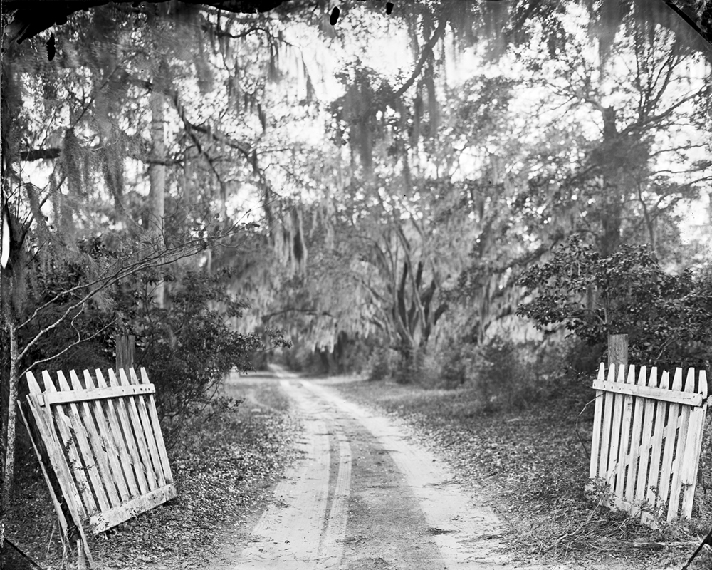
© Virginia McGee Richards, NEW CUT ROAD, WADMALAW ISLAND, For over two hundred years, people living on Wadmalaw Island used this sandy road to reach the New Cut boat landing where a ferry collected travelers and carried them twenty- five miles to Charleston. Although the ferry service was discontinued in the 1900s, the roadbed remains
From the 1700s until the early 1900s farmers living on the sea islands, such as Wadmalaw Island, sent their produce to Charleston on boats. This road led to the New Cut ferry service. This roadway, which appears on maps from the 1700s, still extends from New Cut canal through farmlands on Wadmalaw Island to the main island road.
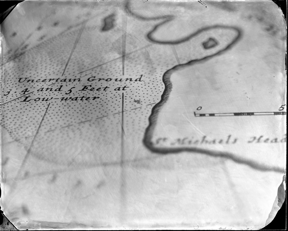
© Virginia McGee Richards, CLOSE- UP OF MAP BY HERMAN MOLL, CIRCA 1711, Archival map showing “Uncertain Ground” and “Low- water” in the harbor at Port Royal, a town located on the waterway south of Charleston that was settled in the early 1700s.
Few maps of the Inner Passage existed in the 1700s. In colonial times, travelers and watermen navigated the Inner Passage route by memorizing the turns through water channels through the marsh. The boatmen steered through the waterway by counting creeks.
Alongside the photographs, Richards includes written reflections and personal accounts that illustrate how memory continues to move through families and communities today. One of the most engaging aspects of the book is hearing descendants recount the stories they inherited and considering how those histories shaped their understanding of themselves, their communities, and their relationship to the land. The book also quietly asks larger questions about historical preservation and collective memory: What responsibility do we have in uncovering and sharing hidden histories? Who becomes responsible for carrying these stories forward? How do storytelling, ritual, and everyday practices allow the past to remain alive across generations?
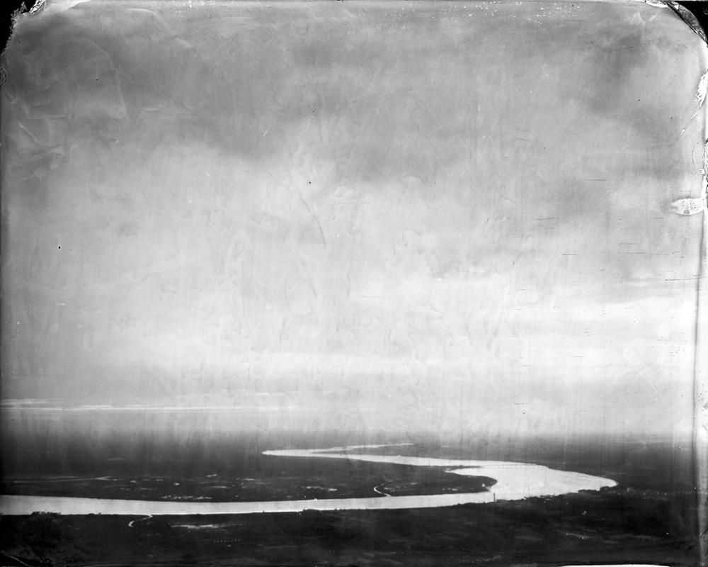
© Virginia McGee Richards, AERIAL VIEW SOUTHWARD OVER THE STONO RIVER, CHARLESTON, In the 1700s and 1800s, settlers and merchants living on the Sea Islands south of Charleston traveled by boat on the Stono River to reach Charleston.
Navigating from Charleston southward on the Inner Passage required boats to travel from the Ashley River through Elliott’s Cut and Wappoo Cut to the Stono River. Rice plantations bordered each side of the waterway with docks along the waterway to load rice, indigo and other crops destined for sale on Charleston’s wharfs. Eliza Pinckney Lucas’ Wappoo Plantation, the first profitable indigo plantation, was located on this section of the Inner Passage in the 1700s.
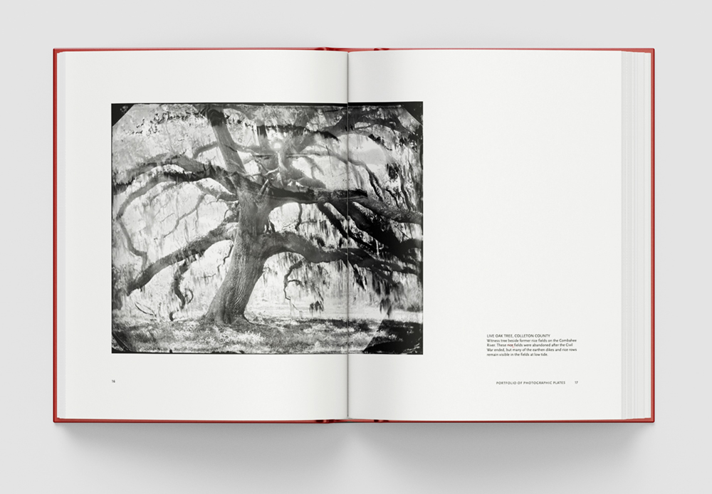
© Virginia McGee Richards, LIVE OAK TREE, COLLETON COUNTY, Witness tree beside former rice fields on the Combahee River. These rice fields were abandoned after the Civil War ended, but many of the earthen dikes and rice rows remain visible in the fields at low tide.
Live oak tree branches grow horizontally outward and balance the tree’s structure during hurricane winds. The branches, which turn and twist during storms, can withstand gale force winds of over 100 miles an hour. Ancient live oak trees stood over the Inner Passage waterway when Indigenous canoes traveled the waterway, and in later centuries as Black watermen rowed boats carrying traders, merchants, planters, and others along this water highway.
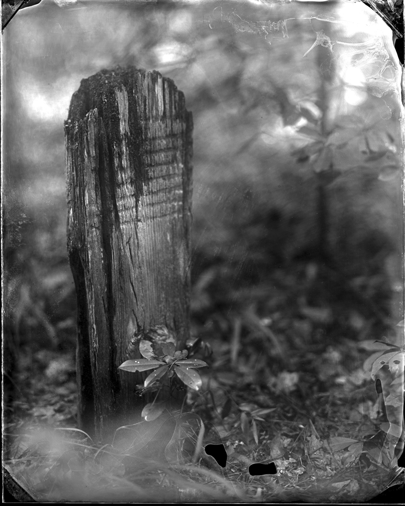
© Virginia McGee Richards, WOODEN MARKER, COOPER RIVER, Grave marker for an enslaved person stands in an abandoned cemetery along the banks of the Cooper River. There is no name indicated on the marker, but seven or eight horizontal lines carved into the cedar wood have survived for over a century.
This wooden marker stands in a forested cemetery where enslaved people were interred at Hyde Park Plantation. Hyde Park Planation was a working rice plantation owned by the Ball family who lived on an adjacent property. Black descendants of people enslaved by the Ball family lived in a one room house close to this cemetery until the mid-1900s. The cemetery overlooks the Cooper River which leads to Charleston.
The contributed essay by Imani Perry, “Along This Way: Living History in Virginia Richards’ Lowcountry Photography,” provides an especially meaningful framework for understanding the work. Perry writes that Richards “has chosen an ethical form of reverence,” a phrase that captures the spirit of the project well. Richards handles the subject matter with sensitivity and care, never sensationalizing trauma or flattening the complexity of Southern history. Instead, the book emphasizes survival, resistance, and remembrance while acknowledging the immense violence that shaped these waterways and the lives connected to them. Her statement, “The land remembers but cannot speak. By documenting the Inner Passage, I want to give the land a voice,” encapsulates the emotional weight and intention behind the project.
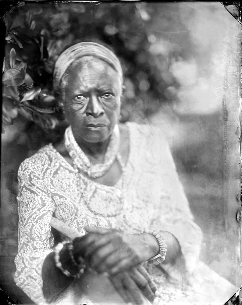
© Virginia McGee Richards, VENNIE DEAS MOORE, GEORGETOWN, Vennie Deas Moore, a cultural historian and author, was born in the fishing village of Awendaw, South Carolina and raised in the city of Charleston by her grandparents. Her people have lived in the Lowcountry for generations; they include Africans, Europeans, Indigenous people, and Gullah Geechee.
Quote from Deas Moore:
The only way you can get to some of the coastal islands in South Carolina is by boat, leaving your car on the mainland. During the time of enslavement, Black workers cut a canal
through the marsh between Sandy Island, South Carolina and the mainland, and even now everyone travels on a boat through that same canal to reach the island. The Sea Islanders who still live there are the descendants of the rice world.
Ultimately, The Inner Passage: An Untold Story of Black Resistance Along A Southern Waterway succeeds because it bridges environmental history, oral history, and photography in a way that feels ethically moral. It is not only a book about the past, but also about how people continue to live with, preserve, and interpret history in the present.
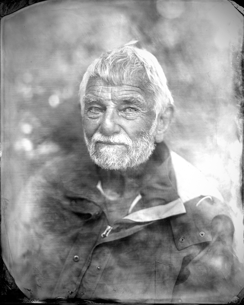
@Virginia McGee Richards, MICAH JOHN LAROCHE III, WADMALAW ISLAND, Micah LaRoche worked as a waterman for decades and navigated a barge on the Inner Passage by “counting Lowcountry creeks,” a technique he learned from his uncle who also worked as a boatman. LaRoche’s family has lived on the Sea Islands of South Carolina since the 1700s.
Quote by Laroche:
As a boy growing up on Wadmalaw Island, my uncle let me pilot a barge that traveled through the inland rivers and creeks. The first time I drove the boat, I misjudged a turn and grounded our barge on a sandbar. We had to wait until high tide for the water to come in and free us. My uncle navigated through the rivers and creeks using a piecemeal map of the water route from Edisto to Charleston. He constructed the map himself by taping pieces of old river
charts together in a long strip. I still have that map.
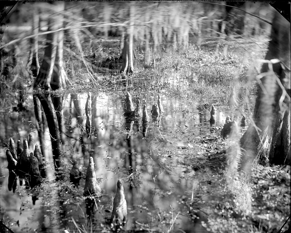
© Virginia McGee Richards, CYPRESS KNEES, COLLETON COUNTY, SOUTH CAROLINA When European settlers arrived in Carolina in the late 1600s, primeval trees covered acres of coastal land. Whole cypress forests were felled at New Cut to create channels for the Inner Passage.
Primeval cypress trees that grew in New Cut canal originally measured 30 feet in circumference. Today, recreational boaters and fishermen who navigate through the Inner Passage can see stumps from these felled cypress trees briefly emerge from the canal banks at low tide. The canal walls are still formed by pluff mud which has an anaerobic quality that has preserved the cypress stumps for centuries.
Ginna McGee Richards is a photographer, researcher and former environmental lawyer whose work is rooted in nature and a sense of place. Born and raised in North Carolina, she grew up surrounded by family, fields and the slow rhythms of Southern life. This intimate connection to land and history forms the foundation of her artistic practice.
As a child, Richards navigated a world that was both insulated and rapidly shifting. She belonged to the first generation of schoolchildren in the United States to attend racially integrated public schools after a landmark Supreme Court decision. That experience—of living within the personal, political, and geographic complexities of the American South—quietly shaped her lifelong curiosity about communities, boundaries and the hidden histories held in landscape.
Her critically acclaimed series The Inner Passage traces a largely undocumented network of 17th and 18th century canals built by Black enslaved laborers. Through years of fieldwork and archival research, she uncovered the environmental and human histories encoded in these waterways. Working with the wet-plate collodion process and a mobile darkroom in remote marshlands, Richards creates images that echo the fluid, unstable terrain they depict. “I want people to read the work as a visual poem,” she says, “to feel the land telling its own story”.
Her career as an environmental lawyer saw her work at the EPA and the Department of Justice, prosecuting environmental crimes and protecting fragile ecosystems. “Landscapes are like manuscripts,” she says. “They record, they hold, and they can render histories—even in the absence of documents.”
Her current and ongoing project, Cultivators and Assassins, explores botanical lineage and the growers who preserve heirloom seed lines, reflecting her continuing interest in how living systems carry memory.
Across all her work one idea persists: the land remembers. Through her lens, photography becomes both reverence and inquiry — a way of listening to place and uncovering the stories it holds.
Richards lives and works in the American South.
Instagram @viginiamcgeerichards
Introduction by Imani Perry
Foreword by James Estrin
60 Photographs by Richards
MIT Press, distributed by Penguin Random House
Book Release: April 2026
Order the book HERE
Instagram: @mitpress
Alayna N. Pernell (b. 1996) is an interdisciplinary artist, writer, and educator from Heflin, Alabama. In May 2019, she graduated from The University of Alabama where she received her Bachelor of Arts in Studio Art with a concentration in Photography and a minor in African American Studies. She received her MFA in Photography from the School of the Art Institute of Chicago in May 2021. Her work reflects the shared experiences of Black women, particularly those shaped by the Deep South. Through photography, text, and sourced materials, she explores the mental, physical, and psychological toll of sustained exposure to visible and invisible injustice, discrimination and violence in both literal and metaphorical spaces.
She has provided lectures about her work at various spaces including Texas Tech University, Colorado Photographic Arts Center, The Sheldon, and Syracuse University, among others. Her work has been exhibited in various cities across the United States, including FLXST Contemporary (Chicago, IL), Refraction Gallery (Milwaukee, WI), JKC Gallery (Trenton, NJ), RUSCHWOMAN Gallery (Chicago, IL), Colorado Photographic Arts Center (Denver, CO), Griffin Museum of Photography (Winchester, MA), among several others. Her work is currently held in private collections at the Museum of Contemporary Photography and the Illinois State Museum.
Pernell was named the 2020-2021 recipient of the James Weinstein Memorial Award by the School of the Art Institute of Chicago Department of Photography, the 2021 Snider Prize award recipient by the Museum of Contemporary Photography, a 2023 Mary L. Nohl Fellowship Emerging Artist recipient, and a 2024 gener8tor Art x Sherman Phoenix Artist. She was also recognized on the Silver Eye Center of Photography 2022 Silver List, Photolucida’s 2021 Critical Mass Top 50, and a 2021 Lenscratch Student Prize Honorable Mention, among others.
She is currently an Associate Lecturer of Photography and Imaging at the University of Wisconsin-Milwaukee, and serves as the Community Engagement Fellow at the Museum of Contemporary Photography. She is also a Content Editor for Lenscratch and a yoga teacher.
Posts on Lenscratch may not be reproduced without the permission of the Lenscratch staff and the photographer.
Recommended
-
Laurie Lambrecht: tēxēreJuly 17th, 2026
-

Daniel Dorsa : To Skip A Sinking Stone : In Conversation with Tracy L ChandlerJuly 16th, 2026
-

Nick Meyer: Good BonesJuly 8th, 2026
-

Robin Dahlberg: Breaking PointJuly 7th, 2026
-
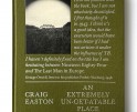
Craig Easton: An Extremely Un-Get-atable PlaceJuly 6th, 2026


